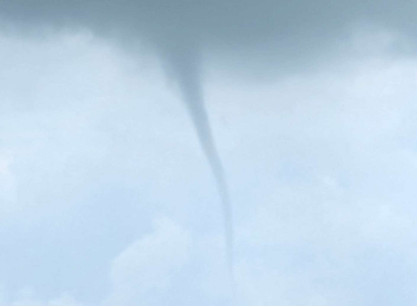
(PHOTO COURTESY OF STEVEN PETERS / THE VILLAGE REPORTER)
By: Jacob Kessler
THE VILLAGE REPORTER
jacob@thevillagereporter.com
A possible funnel cloud was observed a few miles north of Stryker on Sunday, July 20th, during the mid-afternoon hours. According to witness Steven Peters, the funnel appeared between 3:20 and 3:30 p.m., roughly 3 to 4 miles north of town.
Peters reported that the feature formed, dissipated, reformed, and grew longer over a period of about five minutes before fading completely.
A photo captured during its most developed stage shows a narrow, rope-like funnel extending downward from the cloud base, without making contact with the ground.
At the time of the sighting, local temperatures were in the low to mid 70s, with a mix of clouds and moisture present in the region. No tornado warnings were issued, and no damage or injuries were reported.
The atmospheric conditions suggest the feature may have been either a weak funnel cloud or a cold air funnel, both of which share similar characteristics but form under slightly different meteorological setups.
Weak funnel clouds typically form along the edges of developing or dissipating thunderstorm cells, where there is just enough rotation and instability to briefly support a narrow column of rotating air beneath the cloud base.
These funnels often appear during fair-weather summer days when storms are scattered or weakening, and they rarely touch the ground or intensify beyond their visible form.
Cold air funnels, on the other hand, are usually seen during periods of cooler surface temperatures combined with unusually cold air aloft.
They often appear beneath towering cumulus clouds in non-severe weather and are commonly associated with upper-level low-pressure systems.
Though more frequent in spring or fall, they can occur during summer when upper-level conditions allow. They, too, are typically weak and short-lived, seldom reaching the ground or producing damage.
With Sunday’s temperatures sitting at the higher end of what’s typically seen during cold air funnel events, and with no clear thunderstorm structure visible in the image, it remains difficult to confidently classify the phenomenon. However, both scenarios are plausible given the borderline weather pattern in place at the time.
Whatever its exact origin, the funnel cloud offered a dramatic sight in the skies over Williams County and served as a reminder of the atmospheric variety common during the summer months in Northwest Ohio.
Though brief and harmless, its appearance drew attention from local residents and prompted discussion online, where weather watchers shared observations and images of the unusual formation.