

By: Jacob Kessler
THE VILLAGE REPORTER
jacob@thevillagereporter.com
As of Wednesday, April 2nd at 1:30 p.m. the National Weather Service has high confidence that a line of strong to severe storms will make their way through Indiana and Northwest Ohio.

According to NWS Meteorologist Maddi Johnson, these storms will have the potential to put out wind gusts of 60-75 MPH, hail, more heavy rain, and some tornados. A timeframe of between 8:00 p.m. and 11:00 p.m. is currently expected.
Johnson also explained that, while confidence is high for these storms, some uncertainty still remains. The exact severity for our area will depend on a warm front that is coming up from the south.
The higher the temperature and dew point gets will equal more potential energy for the storm system.
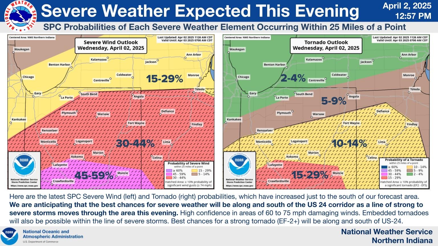
As of right now, the worst of the severe weather looks to reside at and south of US 24 in Defiance and Napoleon, but this could change.

This matches up with what the National Weather Service’s Storm Prediction Office has shown as well, with the highest tornado threat residing at that area.
Currently, Fulton and Williams County sits at an enhanced threat for severe weather, or a 3 out of 5. This is then broken down to show the threat rating for tornados, wind, and hail.
For the tornado threat, our areas sit at a 5% probability of a tornado happening within 25 miles of a point. However, a 10% (with a hatched area) resides just below Fulton and Williams County. A hatched area means that area has the opportunity to see an EF2-EF5 tornado within 25 miles of a point.
For wind, our area sits at a 30% probability of damaging thunderstorm wind gusts of 50 knots or higher within 25 miles of a point.

However, our area is in the hatched section for wind, which shows a 10% or greater probability of wind gusts 65 knots or greater within 25 miles of a point.
As for hail, our area currently sits at a 15% probability of 1-inch diameter hail or larger within 25 miles of a point. The next update for these probabilities is expected to come out around 4:00 p.m. EST.