COLUMBUS, Ohio –– The Ohio Department of Natural Resources (ODNR) has announced new online tools and maps that serve as important tools for water and land-use planning, groundwater resource availability and development, and water resource management.
These interactive tools provide a streamlined process to share important information with industry and public stakeholders who rely on this information for water use planning and research.
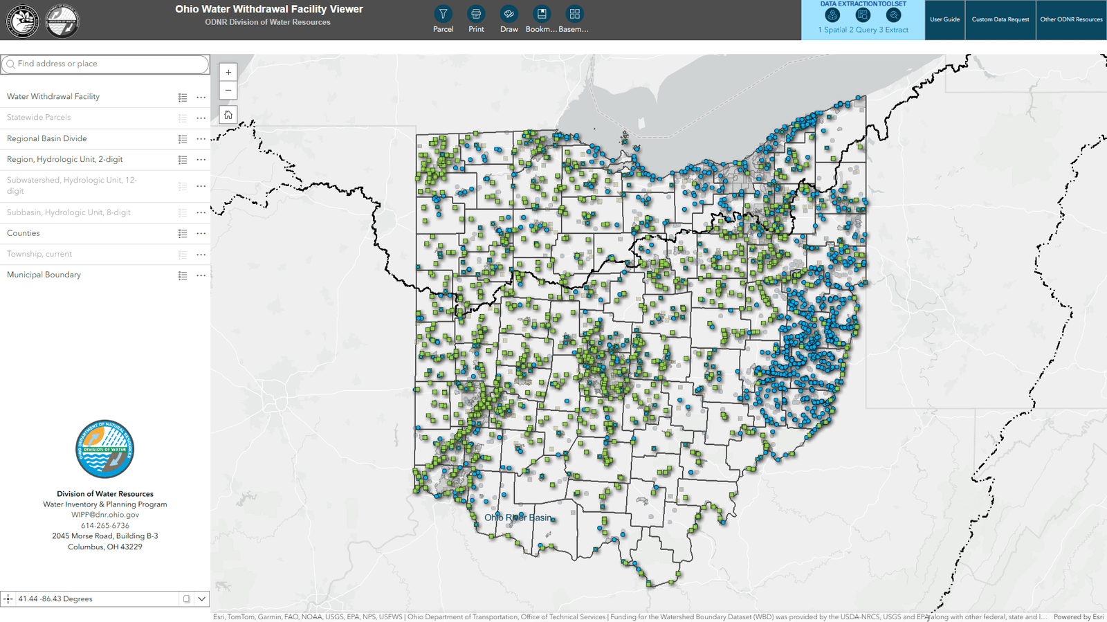
Water Withdrawal Facility Locator Tool
As Ohio experiences an increase in high-capacity water use driven by population growth, industrial expansion, and agricultural needs, it is important to monitor and manage water resources effectively.
The Water Withdrawal Facility Locator Tool shows the locations and high-capacity water use data of water withdrawal facilities in Ohio. This tool also includes historical trend data, which can help stakeholders better understand water usage patterns, proactively address sustainability issues, and better plan for development.
“Access to accurate water use data is essential for informed decision-making and resource management,” said ODNR Director Mary Mertz.
“This tool will empower Ohioans and professionals alike to gain deeper insights into our state’s water resources, promoting transparency and collaboration in addressing our water future.”
Key Features:
- Statewide coverage: Displays the locations of all water withdrawal facilities across Ohio.
- Historical data access: View and analyze historical water use records for individual facilities.
- User-friendly interface: Designed for ease of use by professionals and the public alike.
- Create custom maps: Easily create detailed maps with water use facilities, hydrological features, and unique symbols.
- Versatile applications: Supports research, modeling, consulting, and public awareness.
- Proactive resource management: Identifies high-demand areas to guide decision-making and sustainable water use.
- Query and download all historical water withdrawal data.
Aquifer Yield Map
The new Aquifer Yield Map of Ohio visually depicts the rates at which groundwater may be produced (via pumping) by the aquifer(s) anywhere in the state.
It can be used to assist well drillers, homeowners, municipalities, industries, and agricultural operations in estimating the expected yields of the aquifer(s) in their area of interest.
“ODNR continues to revise and develop its aquifer mapping to ensure Ohioans are prepared for the future,” Division of Geological Survey Chief and State Geologist D. Mark Jones said. “These maps will help us understand and manage Ohio’s groundwater locally, regionally, and statewide.”
Hydraulic Conductivity Map
Created using extensive geologic data, the new Hydraulic Conductivity Map of Ohio—the first statewide compilation of such data for Ohio—provides information about how groundwater moves through the primary aquifer.
The map and its dataset can be used for modeling groundwater flow, predicting how contaminants might move through an aquifer, calculating irrigation rates, and other applications important to land-use development.
“The goal with these maps is to deliver a statewide, data-driven assessment of Ohio’s aquifer resources in a way that can inform responsible development and guide site-specific investigations,” said Craig Nelson, lead hydrogeologist on the mapping project.
“The yield component will be useful for water-well drillers and developers, while researchers, modelers, and engineers will appreciate the hydraulic conductivity component.”
The Aquifer Yield and Hydraulic Conductivity maps were funded in part by an Ohio Water Development Authority Research & Development Grant.
Digital downloads of the aquifer and hydraulic conductivity maps, GIS data, and additional information are available here.
High-resolution printed versions of the maps are available for purchase for $15 each (plus tax and shipping). Please contact the Geological Records Center at (614) 265-6576 or geo.survey@dnr.ohio.gov to order.