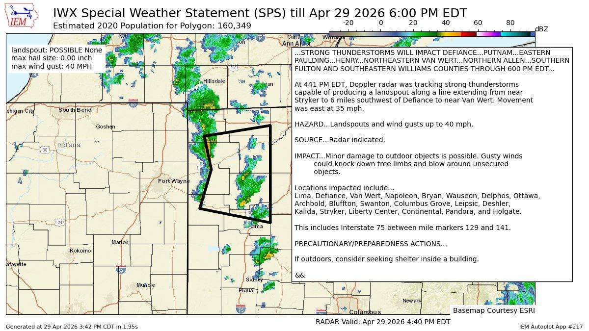
The National Weather Service Northern Indiana office reported funnel cloud activity Wednesday afternoon as showers and thunderstorms moved through northwest Ohio.
A Special Weather Statement was issued until 6:00 p.m. for portions of the region, including Defiance, Fulton, Williams, Henry, Paulding, Putnam, Van Wert and Allen counties.
According to the statement, Doppler radar was tracking strong thunderstorms capable of producing a landspout along a line extending from near Stryker to southwest of Defiance and toward Van Wert. The storms were moving east at 35 mph.
The main hazards listed were possible landspouts and wind gusts up to 40 mph. Locations included in the statement were Bryan, Wauseon, Archbold, Swanton, Defiance, Napoleon, Stryker, Liberty Center, Holgate, Van Wert and several surrounding communities. The statement also included Interstate 75 between mile markers 129 and 141.

The National Weather Service warned that minor damage to outdoor objects was possible, with gusty winds capable of knocking down tree limbs and blowing around unsecured items. Anyone outdoors was advised to consider seeking shelter inside a building.